Closure of the access road for hikes to Mont Veyrier and Col des Sauts.
The access road for hiking up to Col des Contrebandiers and to reach Pré Vernet is completely closed to motorized vehicles.
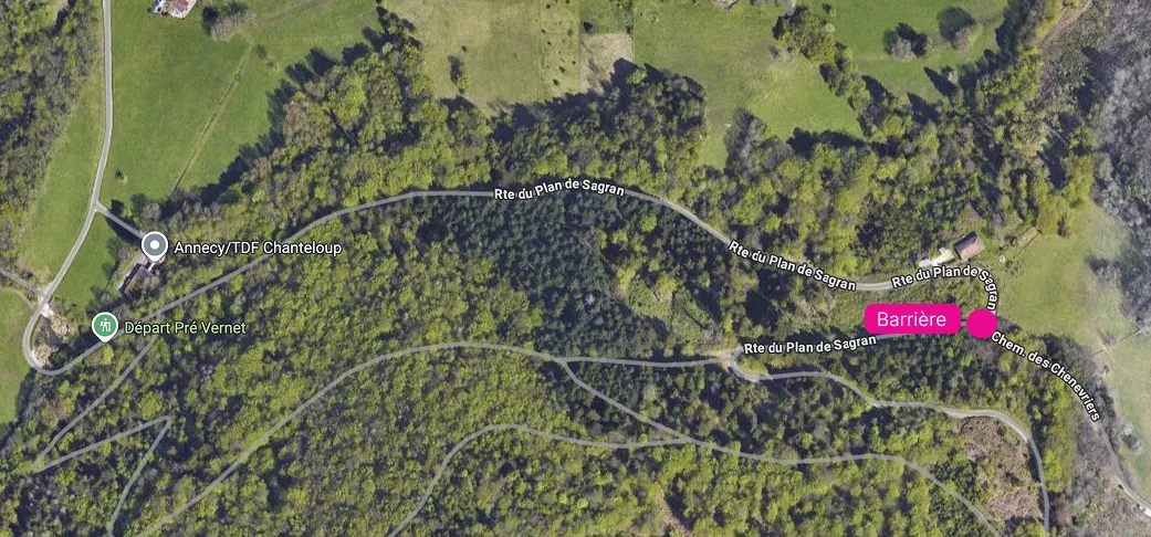
The City of Annecy, the Grand Annecy metropolitan area, the Departmental Council of Haute-Savoie and the commune of Veyrier-du-Lac have put in place a management plan for the Mont Veyrier massif.Since the start of winter 2024/2025, a barrier has been blocking the road just after the junction of Chemin des Chenevriers and Route du Plan Sagran (see image).
Warning: parking outside designated lots will be monitored and fined as of
this summer.
The municipal police regularly patrol to enforce parking rules.
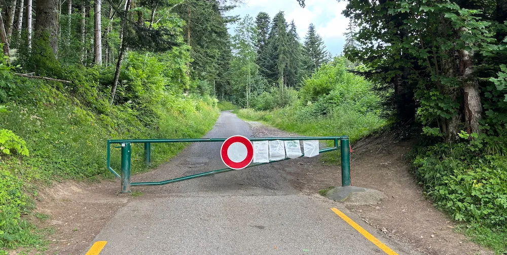
This closure is intended to be permanent.
Please note that parking immediately before the barrier is officially prohibited
(see image).
You may still use the road on foot or by bicycle without restriction. It’s actually much more pleasant without cars.
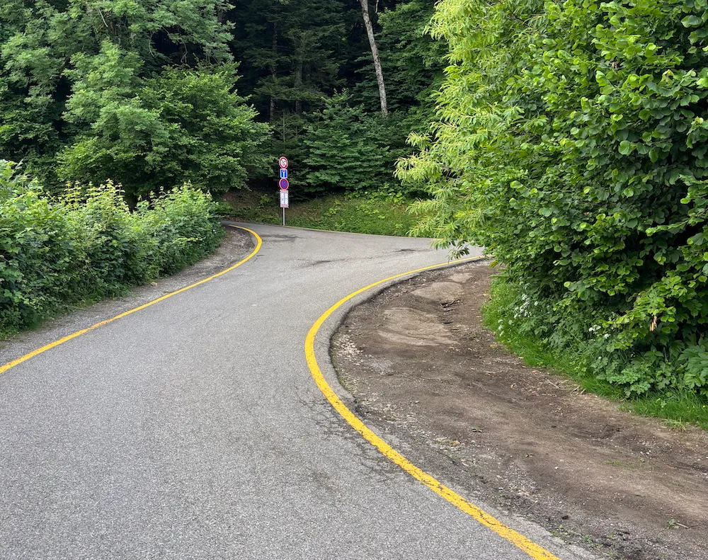
Parking is also forbidden along the road between the start of the forest (just after the bend with the large field and telecom tower) and the barrier.
Consequences of the road closure for reaching Pré Vernet
Many people used to drive to Pré Vernet to hike only the final section up
to the Col des Sauts. That is now impossible.
You must start from a lower point.
The hike to the Col des Sauts is therefore longer and more difficult for children
or less experienced walkers.
Eco-guards on the Mont Veyrier massif
To better protect this natural area and remind visitors of the rules in force, eco-guards are present to:
- raise awareness
- provide information
- guide and support visitors
How to hike up to the Col des Sauts
All access points for hikes—including those to the Col des Sauts or other routes on Mont Veyrier—remain open.
If you wish to hike to the Col des Sauts, you can start from:- The small port by the lake (Chemin rural de la Montagne, Avenue de Chavoires). Longer but easier for navigation.
-
The start of Route du Plan Sagran (in the woods). Shorter, but
navigation is trickier if you join the trails immediately.
Here’s a track to climb up to the Col des Sauts from the “Sur les Bois” neighborhood:
Here are two routes to reach Col des Sauts from the “Sur les Bois” neighborhood:
- Accessible Hiking Trail to Col des Sauts from “Sur les Bois”
- Classic Hiking Trail to Col des Sauts from “Sur les Bois”
Trail conditions on Mont Veyrier
…and for all hikes!The trails on Mont Veyrier are fairly technical and well-worn by heavy use.
They can be steep, root-filled, and rocky. Sturdy, terrain-appropriate footwear is therefore essential.
Since you now start from lower down, the hike to the Col des Sauts will be much longer. You should therefore:- set out early in the cool of the morning
- have at least a basic level of fitness
- carry enough water (no water sources on Mont Veyrier)
- avoid hiking during extreme heat
Frequently Asked Questions
Who can still use the road to the Col des Contrebandiers and Pré Vernet, and how?
Pedestrians, cyclists, emergency vehicles, and authorized residents may continue to use—or park on—the road without being affected by the ban.
Why these measures on the Mont Veyrier massif?
Despite its strong recreational appeal, Mont Veyrier is a sensitive
natural area. Growing visitor numbers harm biodiversity, forest health,
and increase fire risk. Roadside parking obstructs emergency access and
compromises safety. Restoring tranquility and preserving the landscape
will improve the quality of your visit.
These measures are part of the Mont Veyrier Massif Management Plan 2024–2029,
in partnership with the Departmental Council of Haute-Savoie.
What are the main reasons given for closing the road?
The closure aims to ease access for emergency vehicles—often blocked by chaotic parking—and to better regulate massif usage. The increase in campervans and vans parking in the area also prompted the ban.
Which authorities decided on this traffic ban?
The City of Annecy, the Grand Annecy metropolitan area, the Departmental Council of Haute-Savoie, and the commune of Veyrier-du-Lac.
What alternative is proposed for accessing Mont Veyrier now?
You must go on foot via Chemin rural de la Montagne (Avenue de Chavoires, small port) or start from “Sur les Bois.”